This is the route the ops team walks at the start of every season. Seven days door to door from Kathmandu, no flights, no restricted-area permit — which is exactly why Langtang is the trek we point first-timers toward when Everest and Annapurna are fully booked. It is the closest big valley to the capital, it tops out at a real Himalayan viewpoint (Tserko Ri, 4,984 m), and it costs a fraction of the headline treks. It is also the valley the 2015 earthquake hit hardest. You walk through that story on day three.
Day-by-day plan
Day 1 — Kathmandu to Syabrubesi (1,460 m)
The longest sit of the trip. 7–8 hours by road, 122 km that the map says should take three. Public bus leaves Machhapokhari around 07:00 (NPR 800–1,000); a shared jeep is faster and worth it (NPR 1,500–2,000/seat, NPR 18,000–22,000 private). The road is rough past Dhunche and that is where you buy the Langtang National Park entry permit and TIMS card — keep both reachable, there are two checkpoints. Stay in Syabrubesi, not on the road above it; the riverside lodges are quieter and have the better dal bhat.
Day 2 — Syabrubesi to Lama Hotel (2,470 m)
The valley starts here. Cross the river, climb gradually through oak and rhododendron forest along the Langtang Khola. ~6 hours walking, ~1,000 m gain. This is langur and red-panda forest — you almost certainly won't see the panda, but the langurs are loud and constant. Lama Hotel isn't a hotel, it's a cluster of teahouses in the trees; arrive by mid-afternoon because the gorge loses the sun early and it gets cold fast.
Day 3 — Lama Hotel to Langtang Village (3,430 m)
The day that matters. ~5–6 hours walking, ~960 m gain. You climb out of the forest at Ghoda Tabela (army checkpoint, permit check) and the valley opens into yak pasture. Then you reach the landslide field. On 25 April 2015 the earthquake brought half a mountain down onto the old village and killed close to 300 people, locals and trekkers. The new Langtang Village is rebuilt a few hundred metres on, and you cross the debris on a constructed path past a memorial mani wall. Walk it slowly. The teahouses above are new, solid, and run by families who were here for all of it.
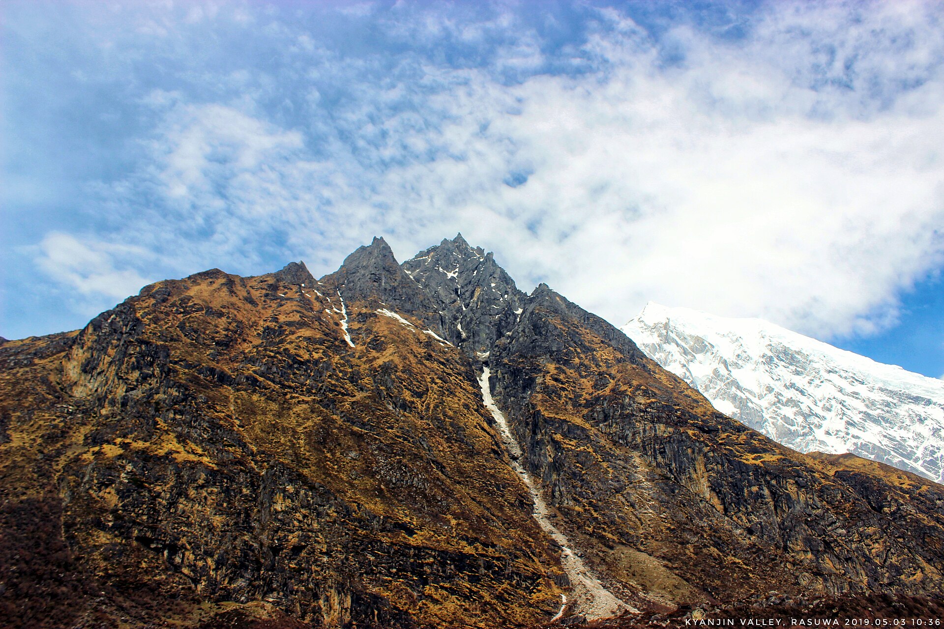
Day 4 — Langtang Village to Kyanjin Gompa (3,870 m)
Short and beautiful. ~3–4 hours walking, ~440 m gain. Past mani walls, water-driven prayer wheels and the old monastery, with Langtang Lirung (7,234 m) filling the head of the valley the whole way. Arrive by lunch — that is deliberate. The afternoon is for an easy acclimatisation stroll up toward the glacier viewpoint, and for the local cheese: the Kyanjin yak-cheese factory is the original, set up with Swiss help in the 1950s, and the cheese is genuinely good.
Day 5 — Kyanjin Gompa: Tserko Ri (4,984 m) and back
The summit day, and the reason you build a night of acclimatisation in. Up at 04:00, headtorch on, ~3–4 hours of steady climbing to Tserko Ri for sunrise over Langtang Lirung, Dorje Lakpa and the Tibetan border peaks. ~5–6 hours round trip. If you slept badly or have any headache, take Kyanjin Ri (4,300 m) instead — it's half the climb for 80% of the view, and pushing to 4,984 m on a bad night is how people get evacuated off this trek. Back at the lodge by mid-morning; rest the afternoon.
Day 6 — Kyanjin Gompa to Lama Hotel (2,470 m)
Retrace and descend. ~6 hours, almost all downhill, which your knees will feel by Lama Hotel. Trekking poles earn their keep today. You move through the whole valley in reverse — village, landslide, forest — and it reads completely differently going down with the altitude behind you.
Day 7 — Lama Hotel to Syabrubesi, drive to Kathmandu
~3 hours back down to Syabrubesi for an early lunch, then the jeep or bus back to Kathmandu. Book the return vehicle the night before — afternoon departures get you into the city after dark, so aim for a morning seat and you're showered in Thamel by evening.
Variations worth knowing
Two common add-ons, both from Kyanjin: a day up the valley to Langshisa Kharka for the glacier and the far peaks, or — for a bigger loop — exiting south over the Ganja La (5,130 m) toward Helambu, which turns this into a serious 10–12 day technical trek that needs a guide, a tent and rope. Most people don't, and shouldn't. The other natural extension is bolting on Gosaikunda from Dhunche on the way out — we'll cover that combination in its own dispatch.
What it costs, roughly
Langtang is the cheapest of the big Nepal treks. Budget on roughly NPR 2,500–3,500/day on the trail for a room, dal bhat twice and tea — call it USD 20–28/day. Add the park permit and TIMS, the two jeep transfers, and a guide if you want one (recommended for the route knowledge after 2015, not because the trail is hard to follow), and a guided seven-day Langtang runs well under what five days at Everest costs you. Permit fees change most years — buy at the Dhunche counter and confirm the current rate there rather than trusting a number you read online.
When to walk it
Mid-October to late November is the cleanest air and the classic season. March to early May brings the rhododendron forest into flower lower down and is our quiet favourite. Winter (December–February) is walkable to Kyanjin but Tserko Ri is often snowbound and brutally cold at dawn. Skip the June–September monsoon — the lower forest section is leech country and the road from Dhunche is the part that washes out.
Seven days, no flight to gamble on, a real summit view and a valley that earned its quiet. If you're choosing your first Nepal trek and the marquee names are full, this is the one we'd put you on.